Rajanpur District—situated between the Suleman mountain range to the west and the Indus River to the east—agriculture and settlements face recurring threats from hill torrent floods, locally known as Rod‑Kohi or spate irrigation flows. Despite receiving low and irregular rainfall, torrential downpours in the Sulaiman Range during the monsoon (usually late July through August) trigger sudden, high‑velocity torrents that rush into the plain, leading to devastating flash floods in vulnerable areas of the district—the so‑called “Pachadh” zone.
Historic Impact & Traditional Management
These floods are part of a centuries‑old tradition of spate irrigation, wherein communities historically built diversion structures and field embankments to harness torrent flows for cultivation—though not without risk. Past British‑era practices included organized desilting with bullock‑drawn ploughs, which have since been neglected after independence, increasing vulnerability in present times.
Major Flood Events: 2010 & 2022
Underlying Causes
Experts highlighted that continuous siltation and encroachment of natural torrent pathways drastically reduced channel capacity, turning former wide nullahs into obstructed drains. This worsened floods during extreme rainfall. Recommendations included urgent desilting, pathway demarcation, small dam construction, and infrastructural strengthening to channel torrents safely into the Indus River.
Response & Mitigation Efforts
Following the 2022 floods, the Punjab Disaster Management Authority (PDMA) issued alerts and mobilized rescue operations, with district authorities breaching highways strategically to redirect torrents and save central urban areas like Rajanpur city. Relief camps were set up, rescue teams deployed, and medical and veterinary assistance launched. Authorities admitted that the torrents that year were up to 400 times stronger than average flows.
Long-Term Solutions Underway
Efforts to address the recurrent torrent hazard include the proposed Murunj Dam (formerly Kaha Sultan Dam) on Kaha Nullah. Intended to store and manage flash flood flows, provide irrigation, and generate hydropower (approx. 6–12 MW), the dam has faced long delays despite being first proposed in 2009. More recently, in May 2025, a Flood Risk Management Survey was launched using satellite-backed enumeration to inform better preparedness and response planning for future torrent floods in Rajanpur and DG Khan Districts.
Overall Summary
Hill torrents—driven by intense rainfall in the Sulaiman Range—are a major natural hazard in Rajanpur District. While historical spate‑irrigation systems once managed these flows agriculturally, modern challenges like mismanaged pathways, encroachments, and climate variability have turned torrents into destructive flash floods. The losses in 2010 and 2022 were unprecedented in scale, affecting hundreds of thousands. Ongoing government initiatives, including structural projects like Murunj Dam and flood surveys, signal a growing commitment to mitigating these risks and safeguarding both lives and livelihoods.
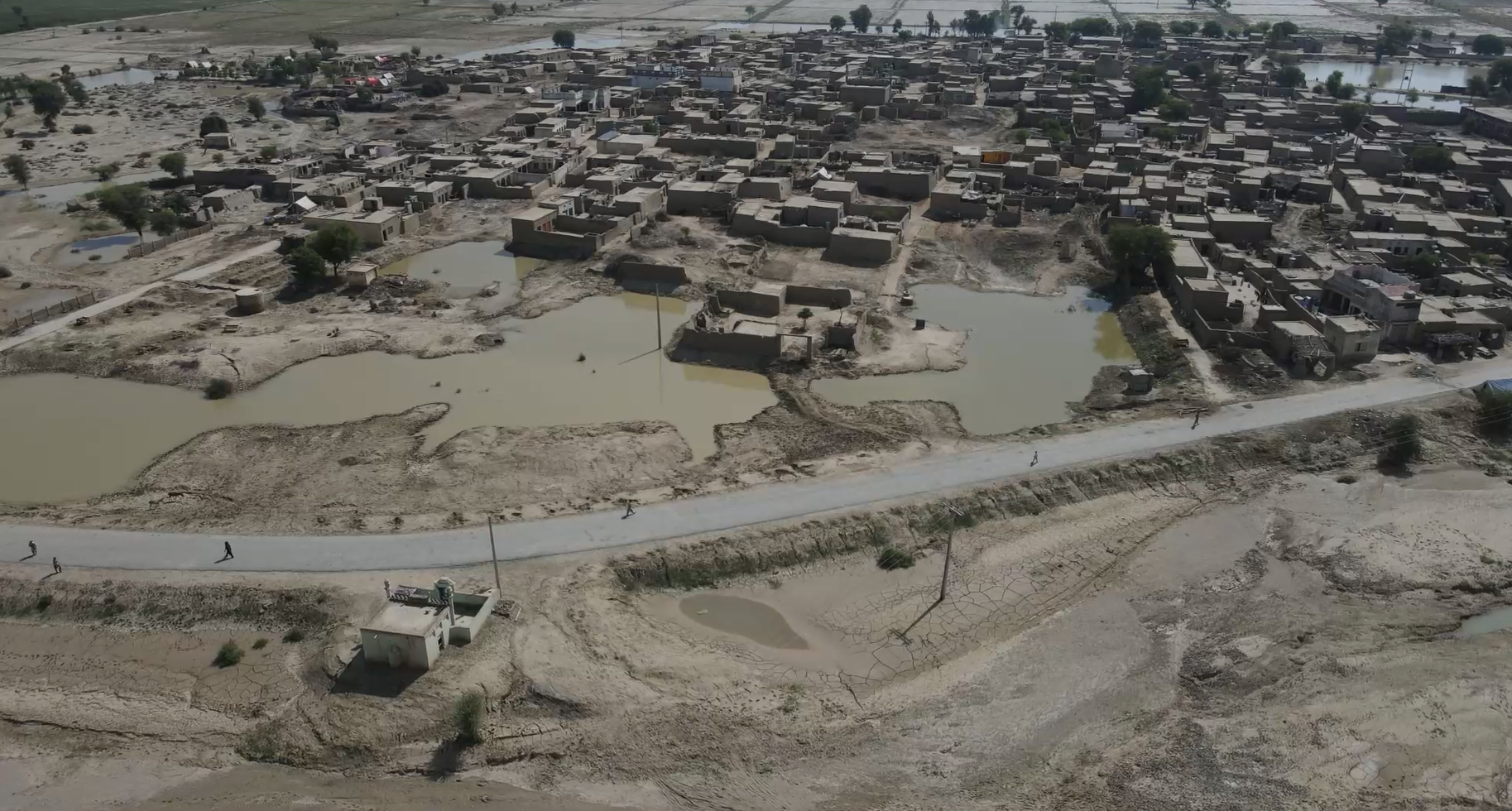
An overview of riverine flooding in Rajanpur District, including its impact on Kot Mithan (Mithankot), offering both historical context and recent developments:
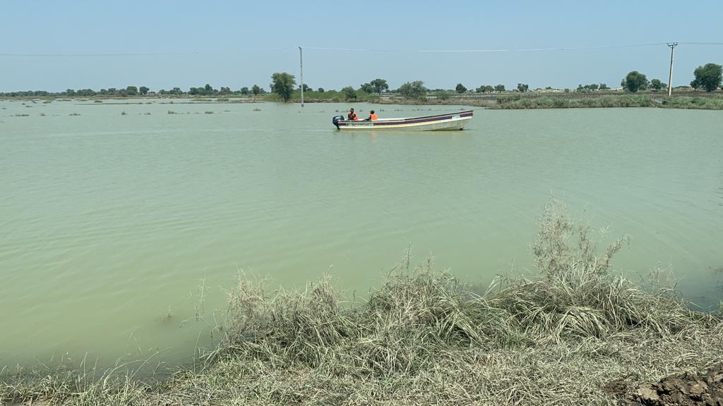
In Rajanpur District, the eastern low-lying zone—known locally as the Katcha area—runs alongside the Indus River and faces recurrent riverine flooding triggered by intense monsoon rains and Himalayan snowmelt. These floods typically occur between July and September when the Indus swells, inundating farmland, homes, and infrastructure in tehsils such as Jampur, Rajanpur, Rojhan, and particularly around Kot Mithan, where the confluence of five rivers places immense hydraulic pressure on the region.
2010 River Flood at Kot Mithan
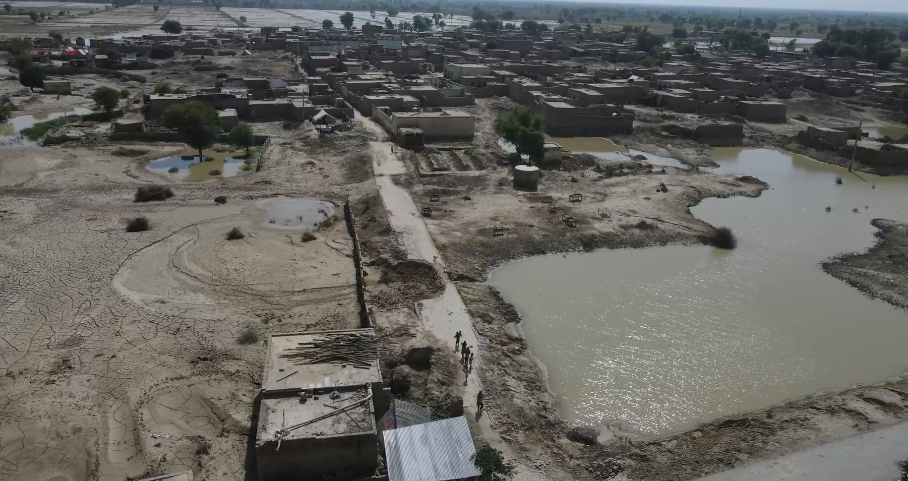
In August 2010, floodwaters breached embankments and entered Mithankot city, threatening the revered shrine of Khawaja Ghulam Farid and rendering hundreds of thousands of people homeless. In total, nearly 324,000 acres of land were destroyed across Rajanpur, and approximately 400,000 individuals were affected by combined hill torrent and river flooding disasters.
2015 Flood Surge
By July 2015, increasing Indus River discharge and a breach at the Mashori Bund intensified flooding around Kot Mithan. With estimated flows reaching 750,000 cusecs, authorities issued evacuation warnings and many villages were submerged, though disaster response helped prevent major loss of life.
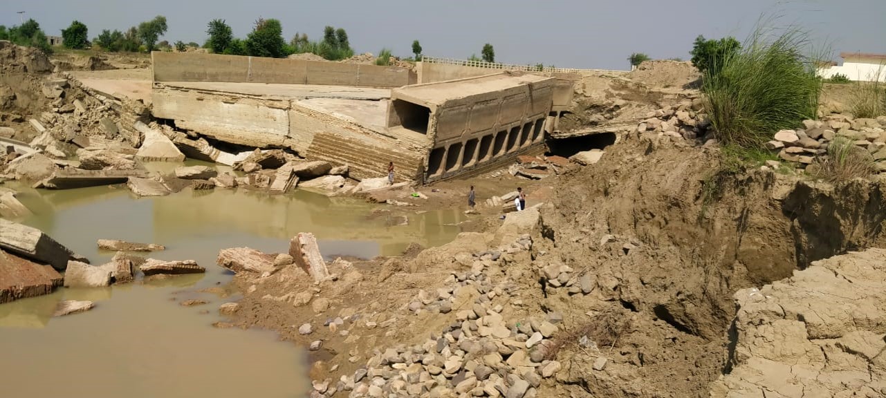
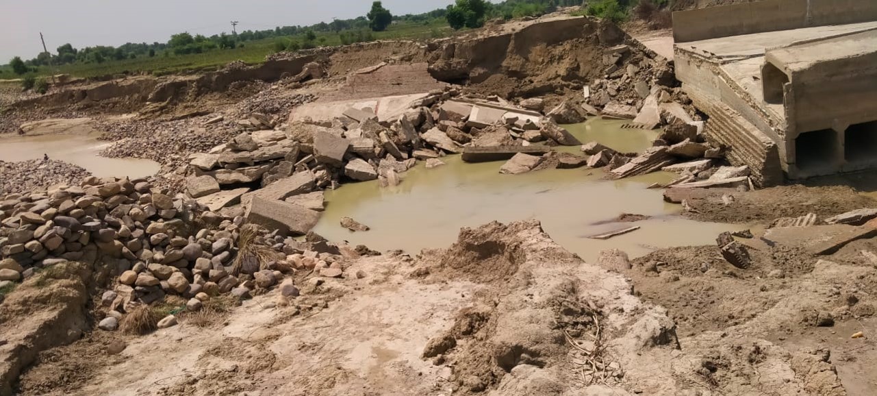
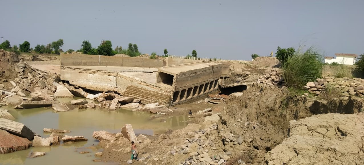
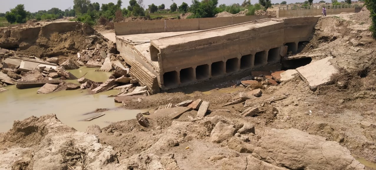
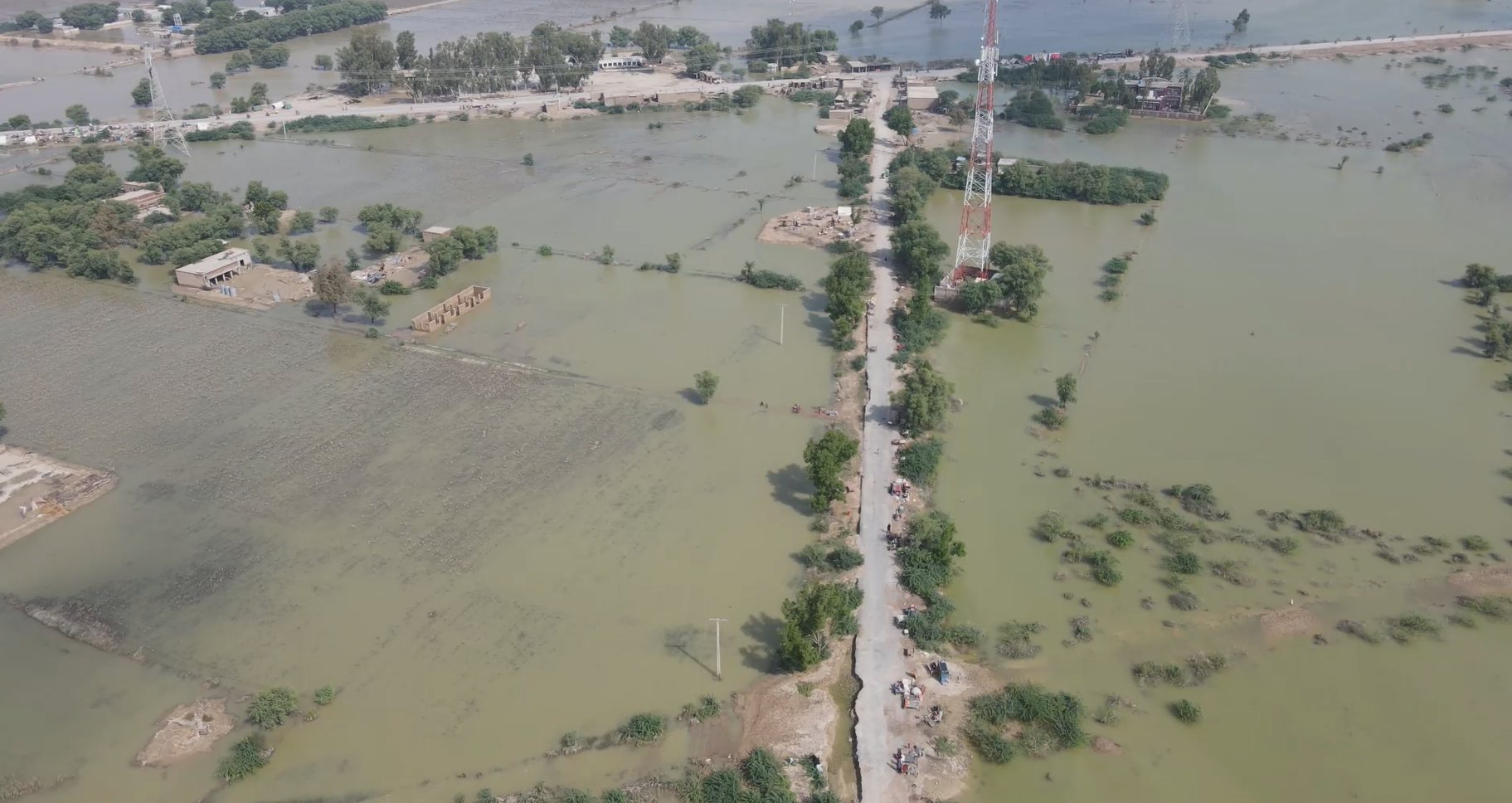
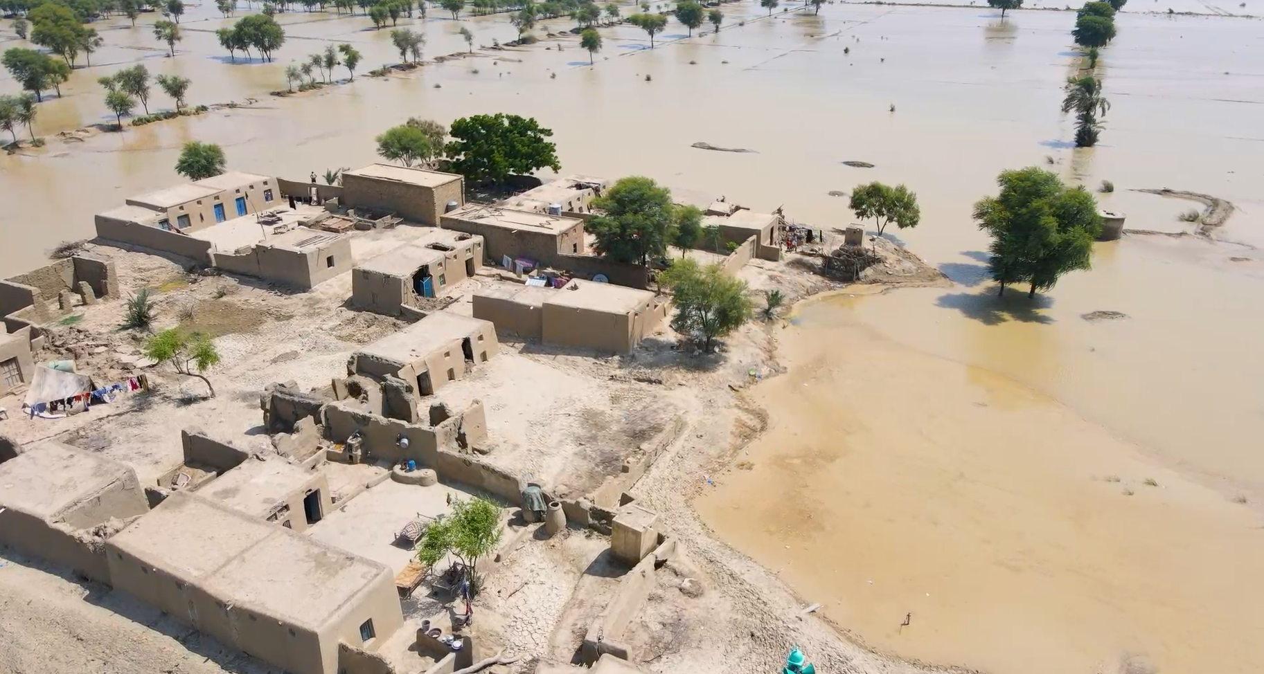
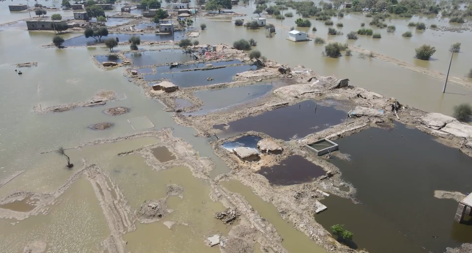
The 2022 Mega-Floods
The monsoon floods of July–August 2022 proved catastrophic: exceptionally heavy rains upstream in India and northern Pakistan drove the Taunsa and Panjnad rivers to record discharges, combining at Kot Mithan to channel over 720,000 cusecs into the Indus. The result was widespread flooding across low-lying Katcha lands, submerging crops like cotton and sugarcane over thousands of acres, and displacing tens of thousands of riverine residents.
Underlying Causes & Impacts
Several factors exacerbate riverine flooding in the region:
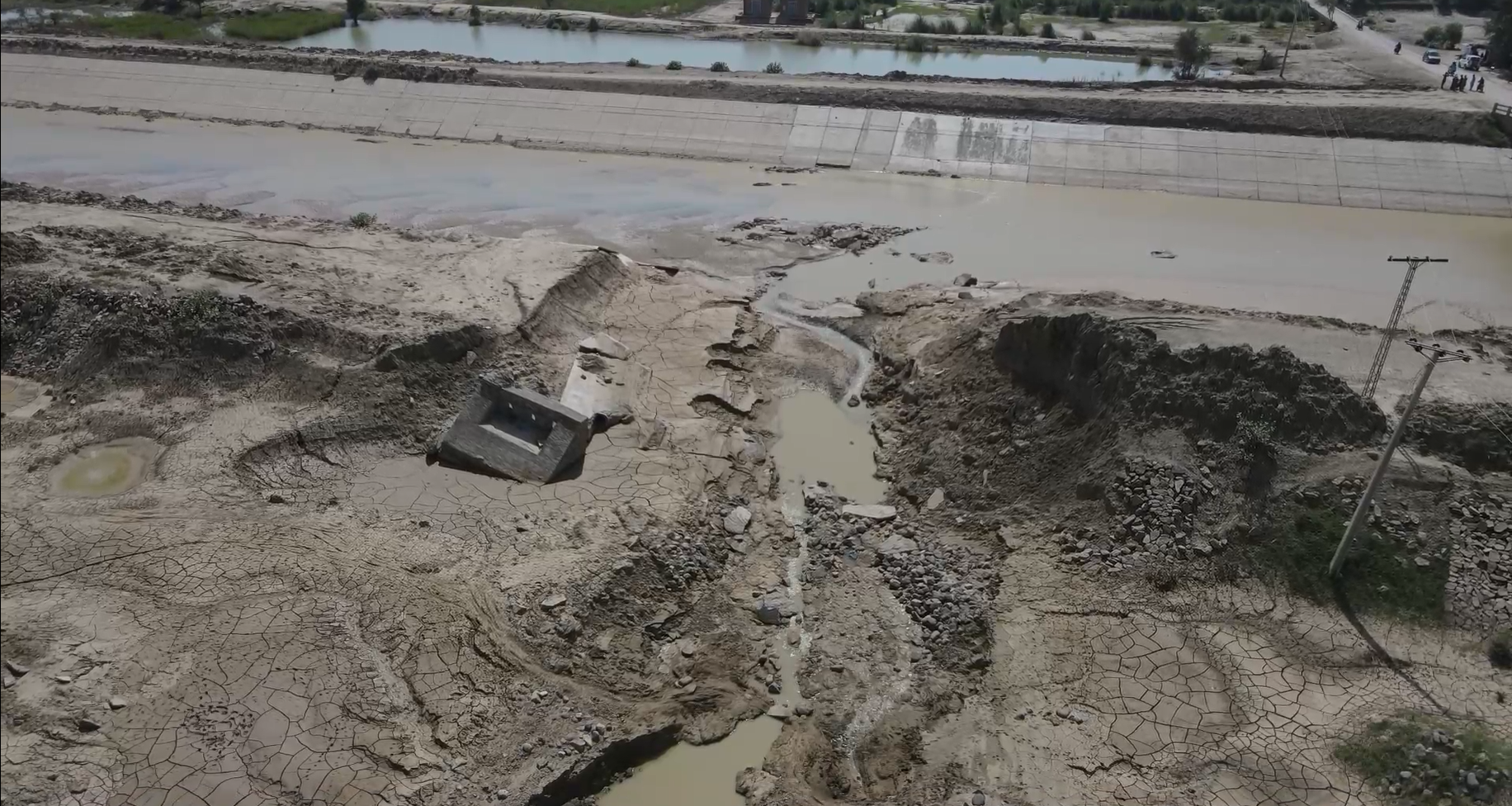
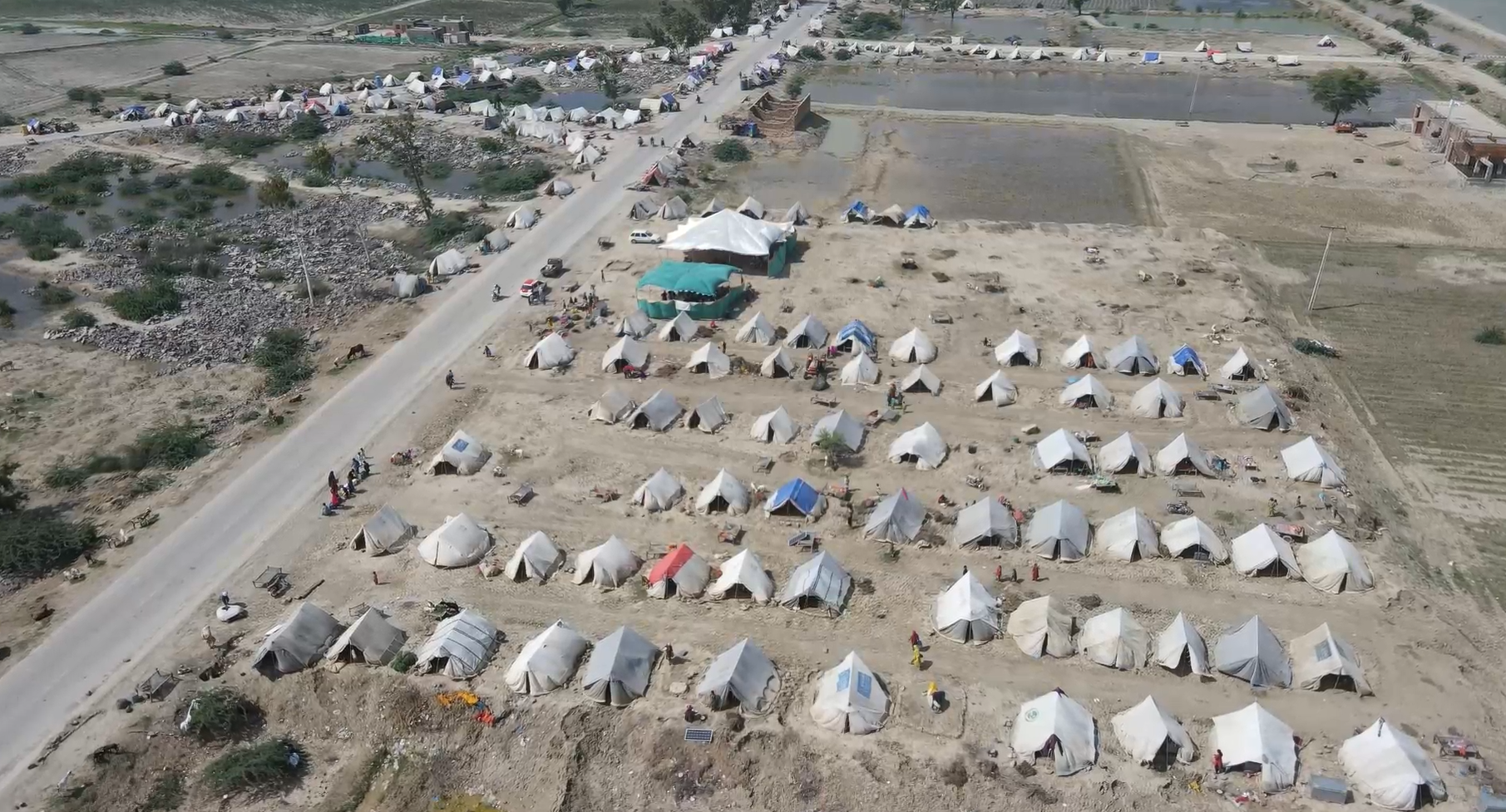
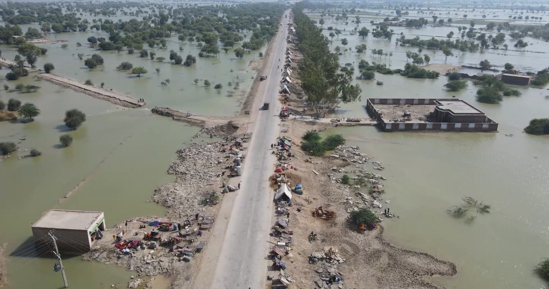
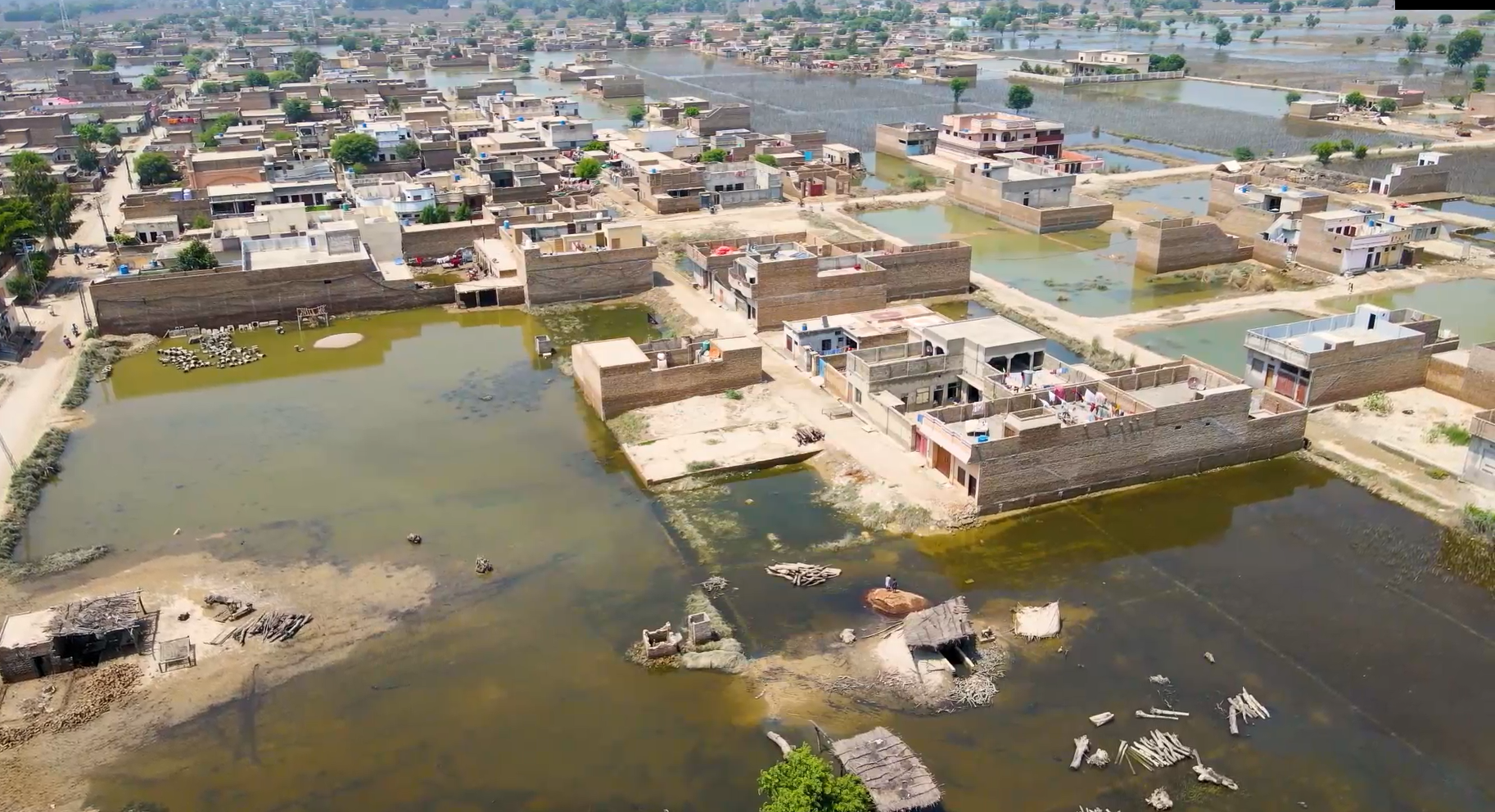
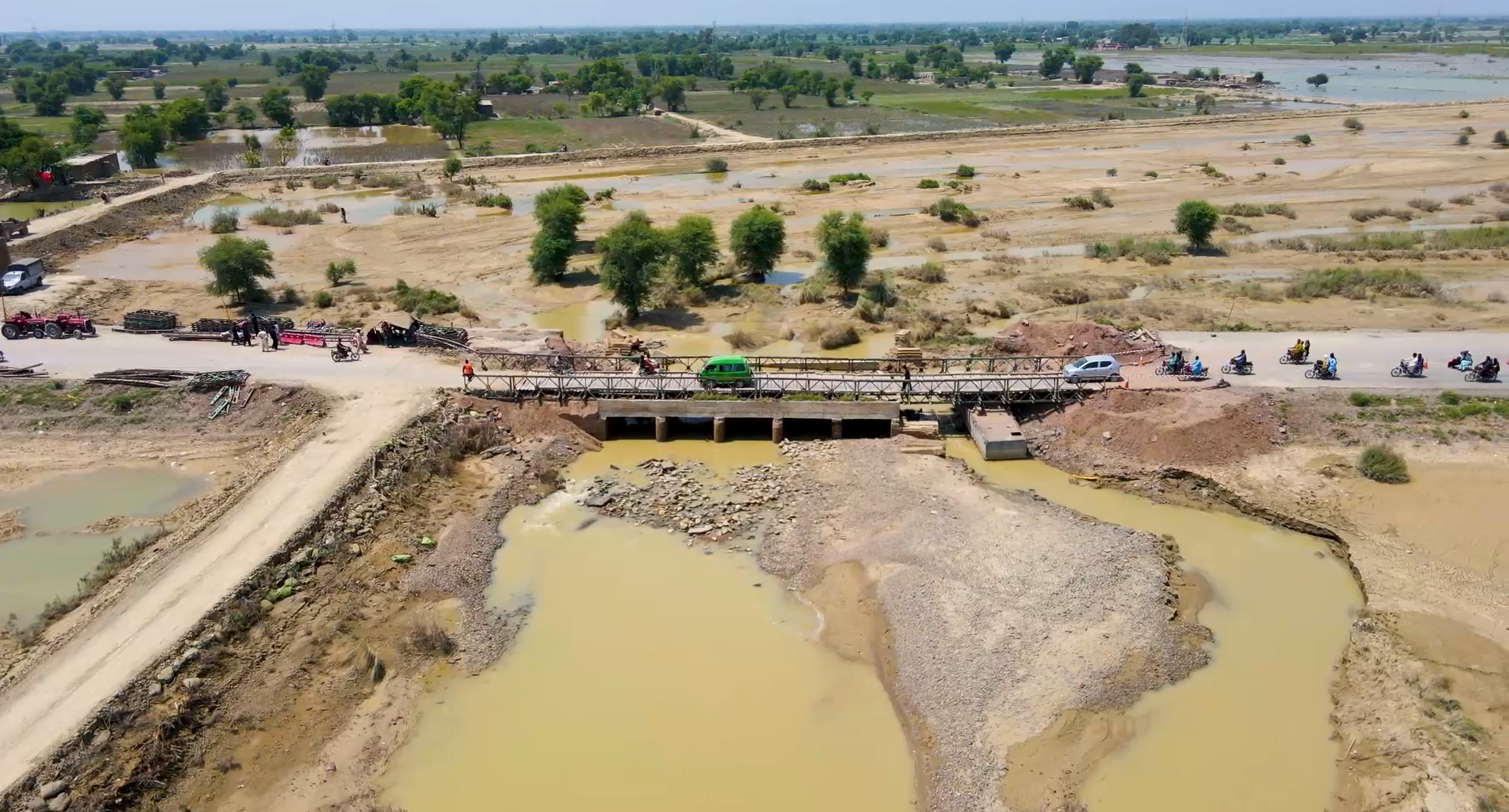
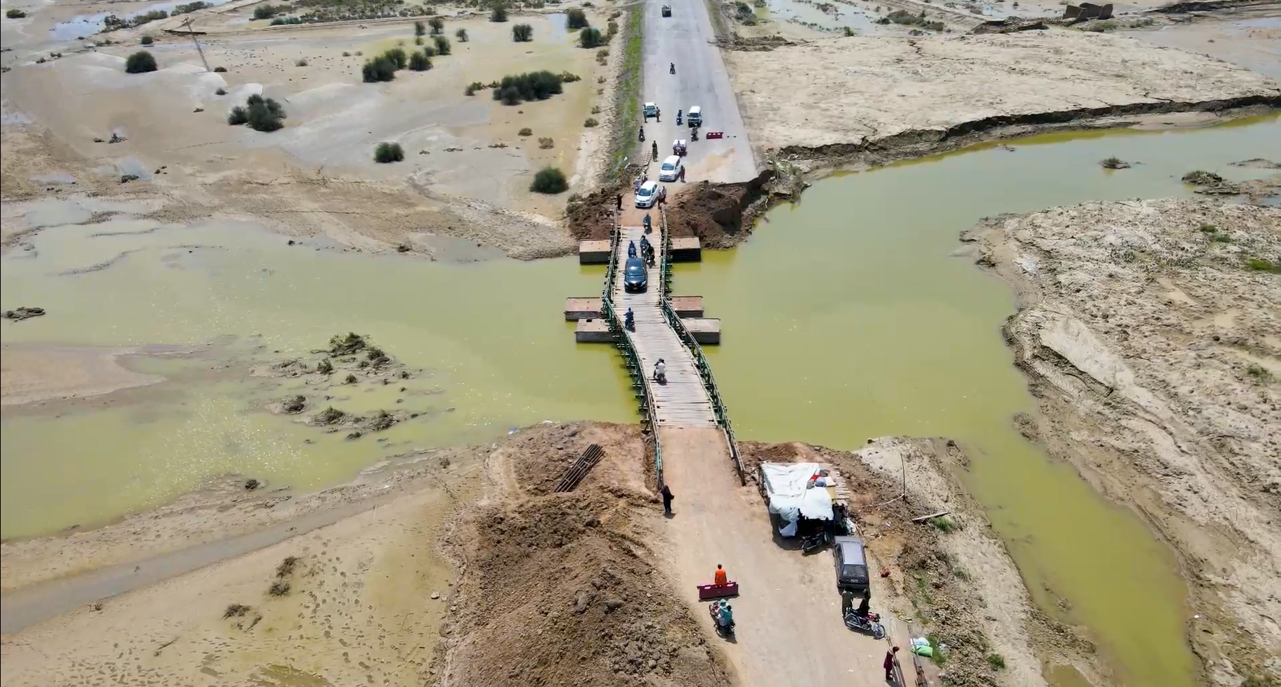
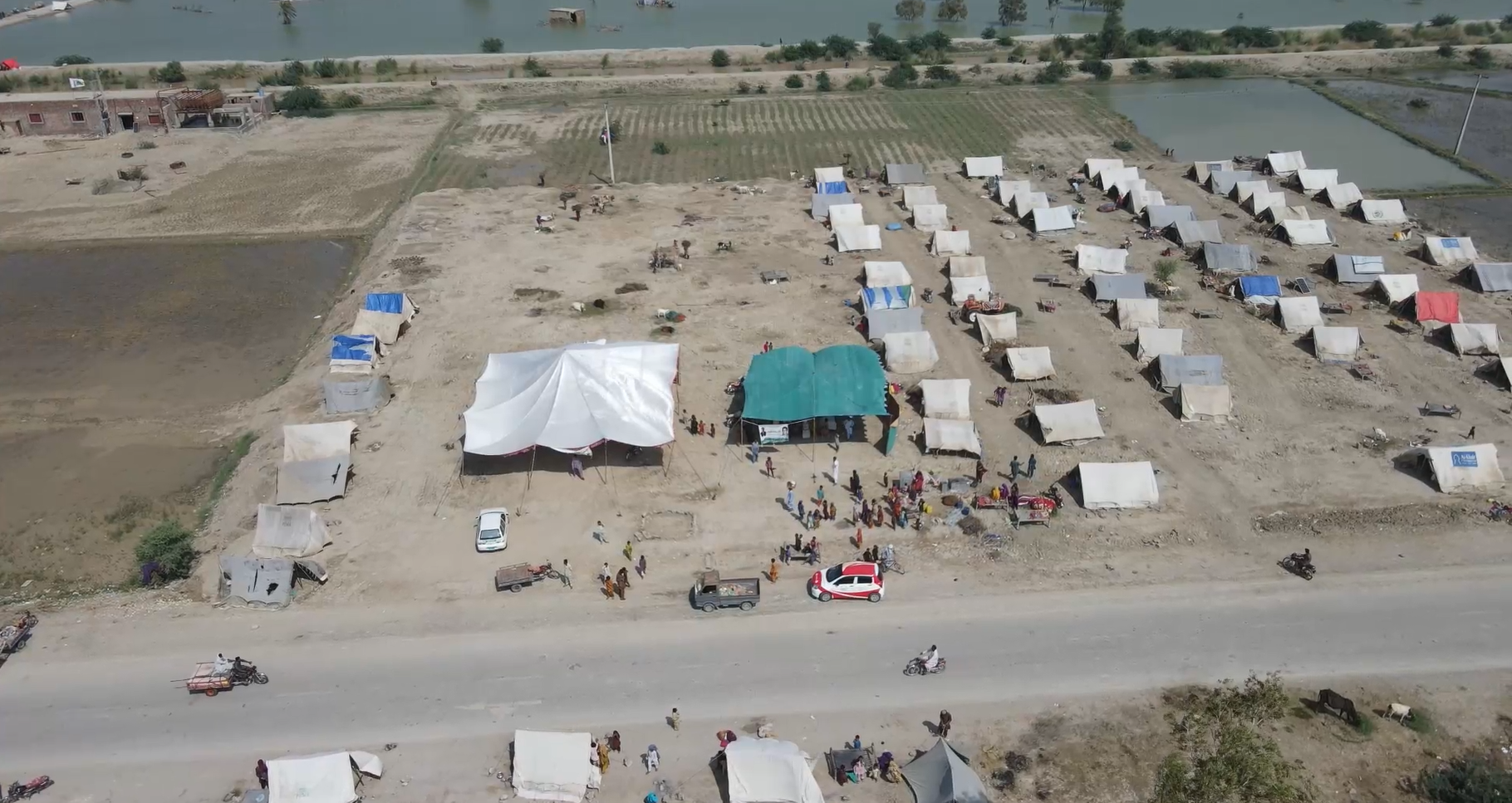
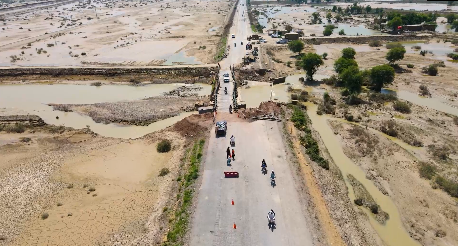
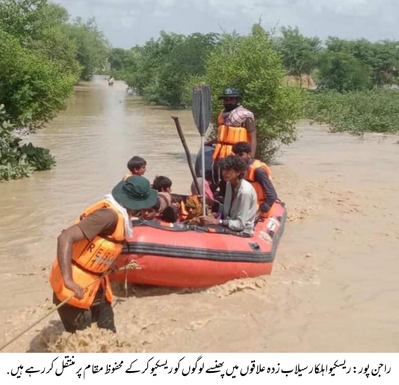
Community & Administrative Response
Local authorities have periodically implemented emergency measures such as planned breaches to redirect floodwater, establishment of relief camps, and evacuations using boats. During the 2022 floods, refugee operations saved over 1.1 million people, but infrastructure damage—roads, schools, houses—was widespread. Thousands of hectares of crops were lost, and many communities remained displaced long after flood waters receded.
In 2022, during the devastating floods in Rajanpur, the then Deputy Commissioner, Mr. Arif Rahim, took a proactive step by preparing a comprehensive policy paper for Torrential Flood 2022 in Rajanpur. The document emphasized the urgent need for a robust flood protection mechanism to mitigate risks, particularly in the face of increasingly unprecedented rainfall events linked to climate change.
During the emergency response, the District Administration, along with various NGOs and INGOs, encountered significant challenges in accessing the most vulnerable areas due to stagnant water ponds and a severely damaged road network. In response, Flood prone area was mapped and plotted on Google Earth to identify high-risk and inaccessible areas, and facilitating the evacuation of affected populations and the delivery of relief supplies on a priority basis.
The entire dataset was digitally documented and visualized in the form of a Hazard Map, providing critical insights for disaster response teams and laying the groundwork for future flood preparedness and mitigation strategies.